Zoom Earth
- Weather
- 3.1
- 28.5 MB
- by Neave Interactive
- Android 8.0+
- Apr 25,2025
- Package Name: com.neave.zoomearth
Zoom Earth provides an interactive platform for tracking hurricanes, typhoons, and tropical cyclones in real-time, enhancing your ability to monitor these weather phenomena with precision. This tool is essential for staying informed and prepared during storm seasons.
Key Features
Satellite Imagery: Zoom Earth utilizes near real-time satellite imagery from sources like NOAA GOES, JMA Himawari, EUMETSAT Meteosat, and NASA's Aqua and Terra satellites to offer comprehensive views of weather patterns across the globe.
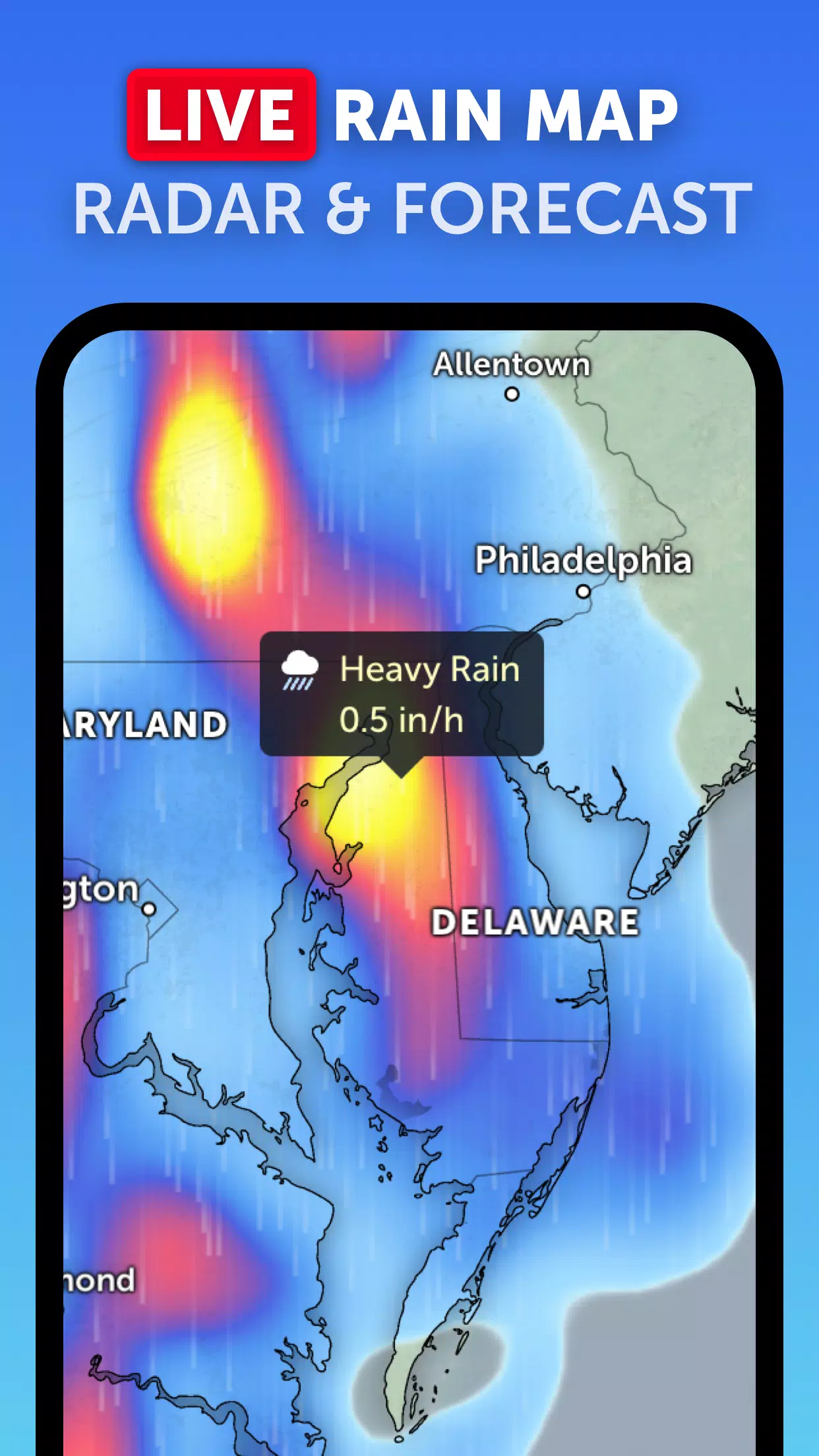
Rain Radar: With our advanced weather radar map, you can track rain and snow in real-time, thanks to data from ground-based doppler radar, helping you stay ahead of any approaching storms.
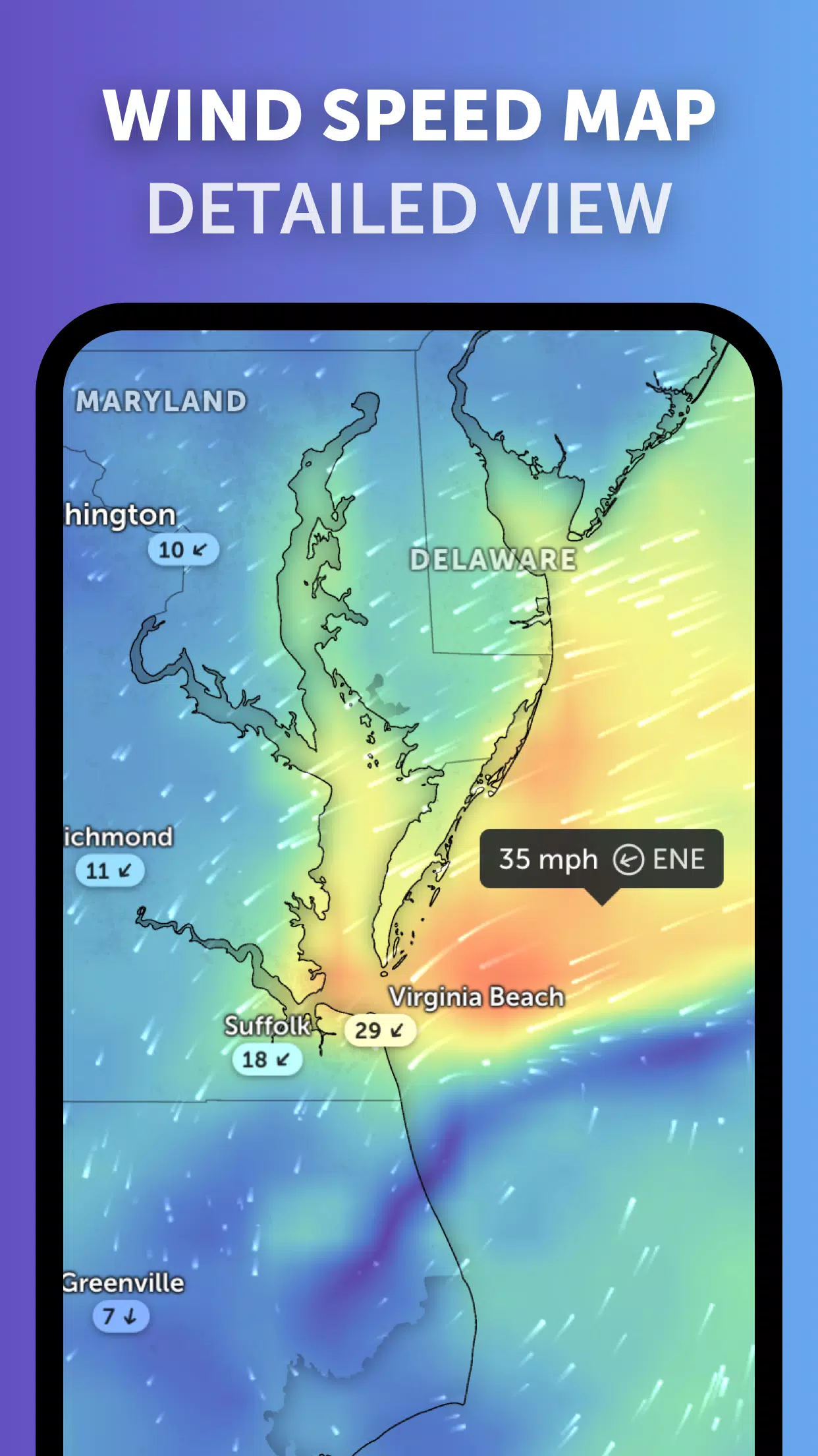
Weather Forecast Maps: Experience detailed and visually appealing global forecast maps that cover essential weather metrics such as precipitation, wind speed and gusts, temperature, "feels like" temperature, relative humidity, dew point, and atmospheric pressure.
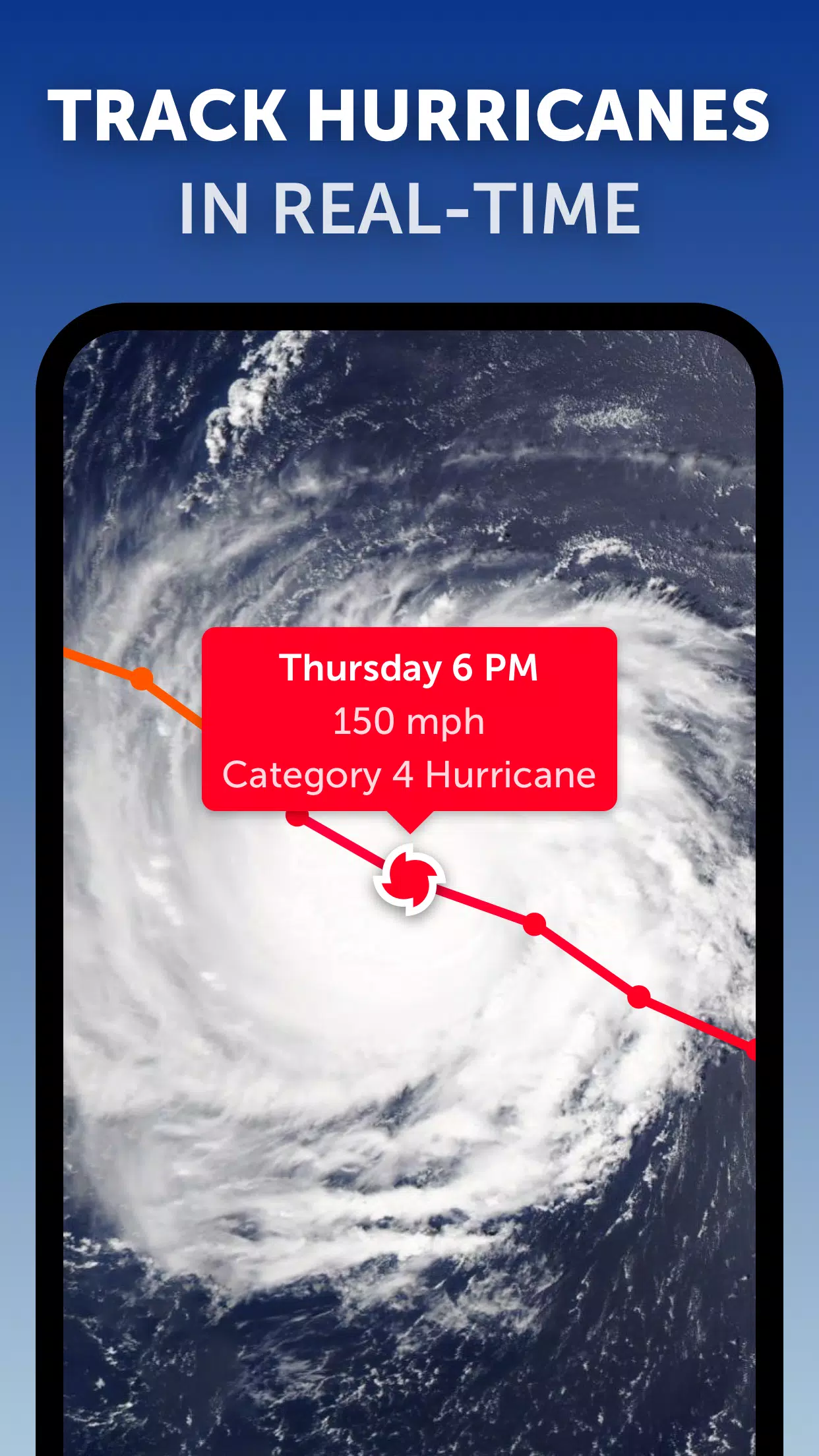
Hurricane Tracking: Our state-of-the-art tropical tracking system allows you to follow the progression of hurricanes from their initial development to reaching category 5 status, using the most current data from the National Hurricane Center (NHC), Joint Typhoon Warning Center (JTWC), Naval Research Laboratory (NRL), and the International Best Track Archive for Climate Stewardship (IBTrACS).
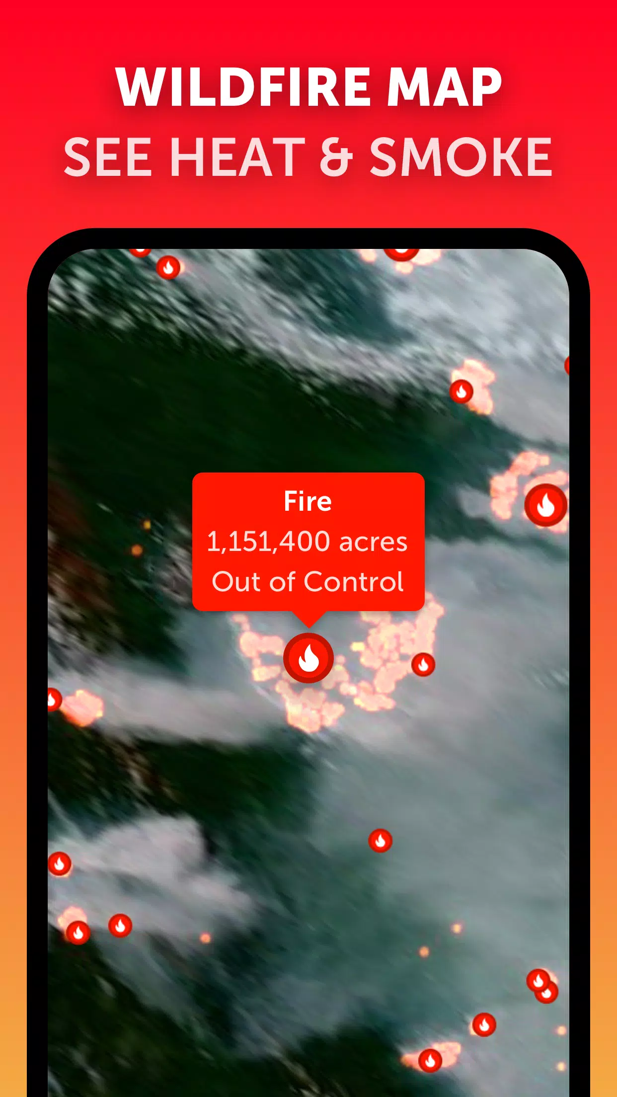
Wildfire Tracking: Stay updated on wildfires with our active fires and heat spots overlay, which highlights areas of high temperature detected by satellite, updated daily through NASA's Fire Information for Resource Management System (FIRMS).
Customization: Tailor your experience with settings that allow you to adjust temperature units, wind units, time zone, animation styles, and more, ensuring the tool meets your specific needs.
What's New in the Latest Version 3.1
Last updated on Sep 19, 2024
- Enhanced user interface with reduced clutter for viewing multiple tropical systems.
- Separate alert systems for Atlantic and Eastern Pacific tropical systems, improving the clarity and relevance of notifications.
- Improved map labels for a more intuitive navigation experience.


-
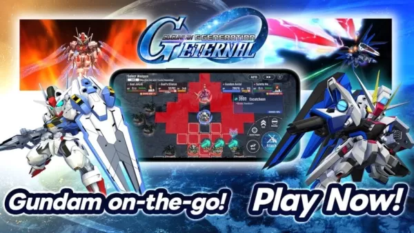 "SD Gundam G Generation ETERNAL Now Available on Android"
Bandai Namco has just released the highly anticipated game, *SD Gundam G Generation ETERNAL*, allowing players to assemble their own squad of Mobile Suits from the vast Gundam multiverse. Dive into epic turn-based battles with your custom team and witness the clash of iconic mechas!SD Gundam G Gener
Apr 25,2025 -
 How to Get I Caught a Shooting Star Trophy/Achievement in Monster Hunter Wilds
In *Monster Hunter Wilds*, while many achievements focus on taking down the largest and most formidable creatures, there's a unique challenge in capturing one of the smallest: the Sandstar. If you're aiming to unlock the 'I Caught a Shooting Star!' trophy/achievement, here's a comprehensive guide to
Apr 25,2025 - ◇ "Tribe Nine Unveils Chapter 3 Trailer: Neo Chiyoda City Coming Soon!" Apr 25,2025
- ◇ "Using Tarot Cards Effectively in Balatro: A Guide" Apr 25,2025
- ◇ Next-Gen Xbox Slated for 2027, Handheld in 2025 Apr 25,2025
- ◇ "Switch 2 Zelda Ports: Repair Equipment via Zelda Notes App" Apr 25,2025
- ◇ M3GAN Re-Release: Enhanced with 'Second Screen' and Live Chatbot Apr 25,2025
- ◇ Red Rising Board Game Now 54% Off on Amazon Apr 25,2025
- ◇ Matt Murdock and Wilson Fisk Face New Foe in Daredevil: Born Again Apr 25,2025
- ◇ Madame Bo Set to Enter Mortal Kombat 1 Apr 25,2025
- ◇ "New Alien: Earth Trailer Unveiled, Showcasing Xenomorph and Nod to 1979 Classic" Apr 25,2025
- ◇ Developer Warns: The Witcher 4 Beta Tests Are Scams Apr 25,2025


- 1 Pokémon GO Set To Roll Out Safari Ball In The Wild Area Event 2024 Nov 10,2024
- 2 Marvel's Spider-Man 2 Swings to PC in January 2025 May 26,2023
- 3 Tomorrow: MMO Nuclear Quest Is a New Sandbox Survival RPG Nov 15,2024
- 4 Black Myth: Wukong Review Fallout Nov 13,2024
- 5 Roblox Ban in Turkey: Details and Reasons Mar 10,2024
- 6 Final Fantasy XVI PC Port Falls Short Nov 14,2024
- 7 GTA 6 Raises The Bar and Delivers on Realism Beyond Expectations Nov 10,2024
- 8 Dragonite Cross-Stitch Captivates Pokémon Enthusiasts Nov 08,2024


-
Best Racing Games to Play Now
A total of 10
-
Explore the World of Shooting Games
A total of 10
-
Best Free Simulation Games for Your Android Phone
A total of 4