Sea Level Rise
- Weather
- 3.0.9
- 56.2 MB
- by Concursive Corporation
- Android 6.0+
- Apr 25,2025
- Package Name: com.sealevelrise
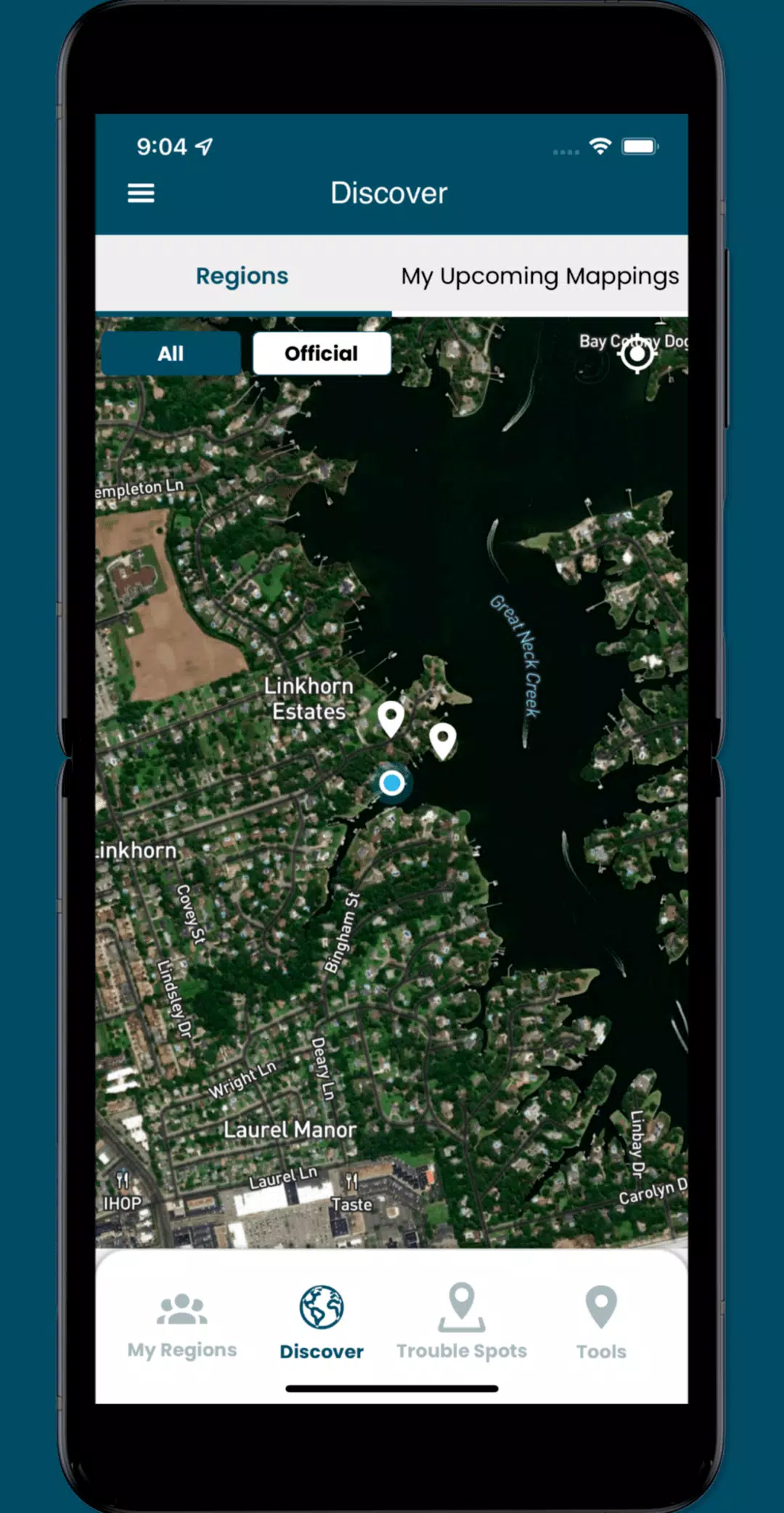
Participate in crowd-sourcing events to capture sea level rise data with the Sea Level Rise app, a powerful tool that empowers individuals to map flooding in their communities. This innovative app helps document the impacts of sea level rise and other flooding events, providing invaluable data for researchers and civic leaders alike.
Sea level rise is a global issue that affects virtually everyone in low-lying coastal regions. Our journey began in Hampton Roads, Virginia, where we've harnessed the power of thousands of volunteers during annual "Catch the King Tide" events. Developed by Wetlands Watch, this app fosters a better-informed and connected community, enabling us to stay ahead of the rising tides.
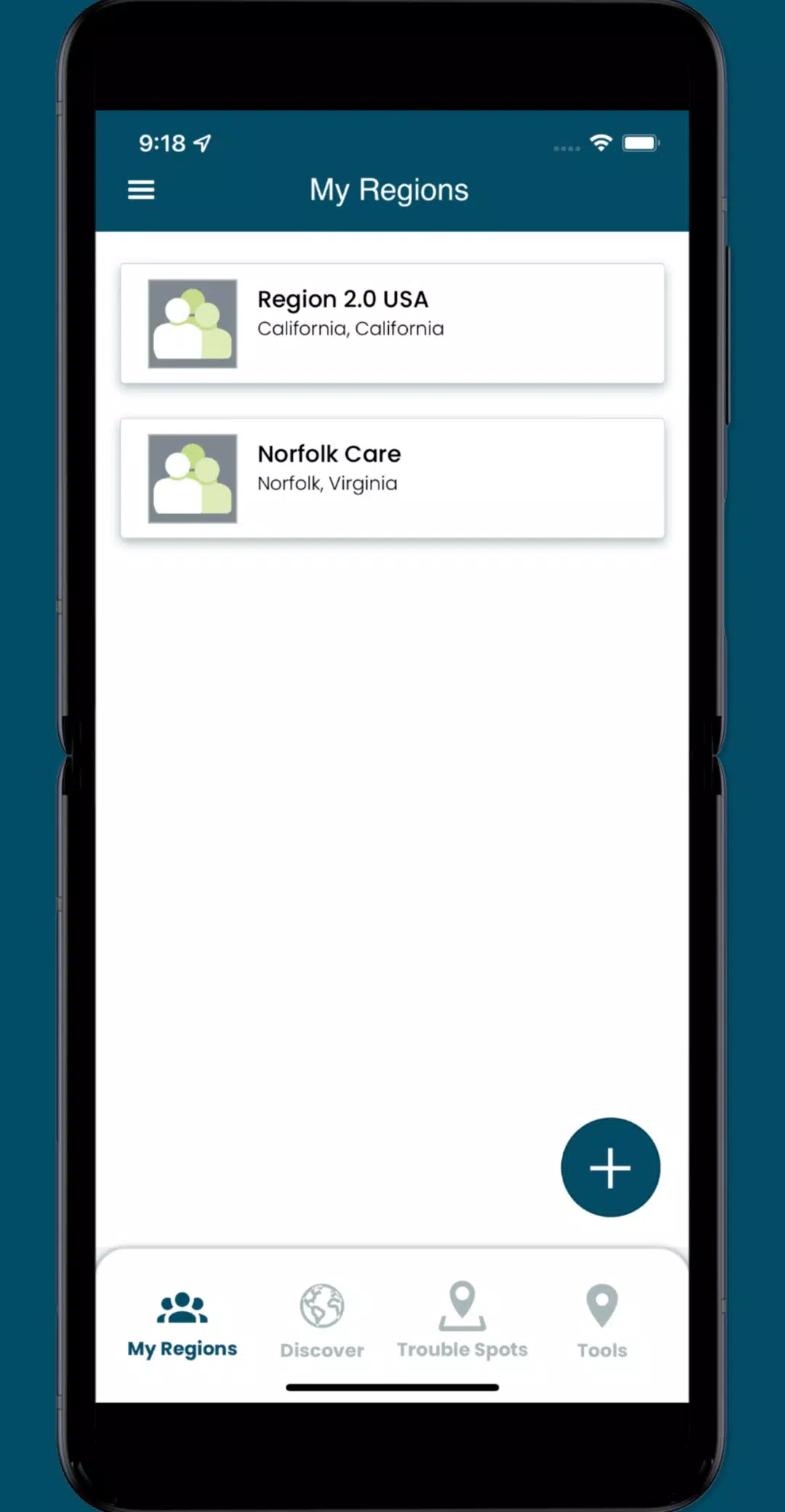
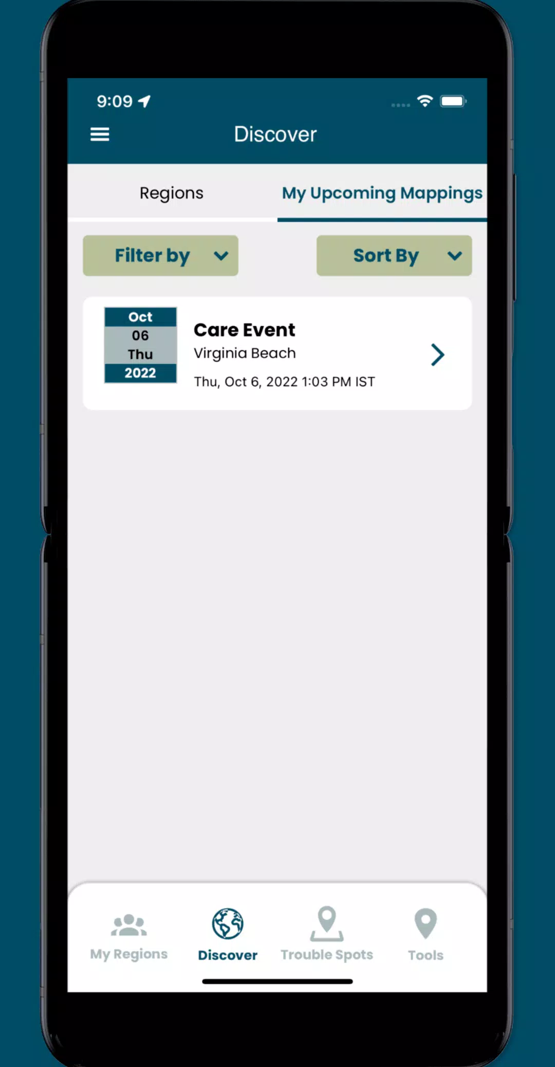
By using the Sea Level Rise app, you can access user-submitted information about this global phenomenon and actively participate as a volunteer in capturing crucial street-level data. This data is essential for understanding and addressing the challenges posed by sea level rise. With the app, you can:
- Participate in crowd-sourcing events to capture localized data that researchers and civic leaders need but often lack.
- Identify and add nearby "Trouble" spots where high water impacts your travel during inclement weather.
- Capture and share photos that document the flooding occurring in your community.
- Access specific collaboration spaces, called regions, where you can manage volunteers and schedule mapping events.
What's New in the Latest Version 3.0.9
Last updated on Oct 19, 2024
Update the following functionality:
- Implemented minor UI enhancements and resolved several issues throughout the app.


-
 DC: Dark Legion Heroes Ranked (2025)
In the expansive universe of DC: Dark Legion, where heroes and villains from the DC roster come together, the possibilities for team-building are endless. Yet, not all characters are on the same level when it comes to effectiveness in this RPG. Some characters can lead your team to victory in any ch
Apr 25,2025 -
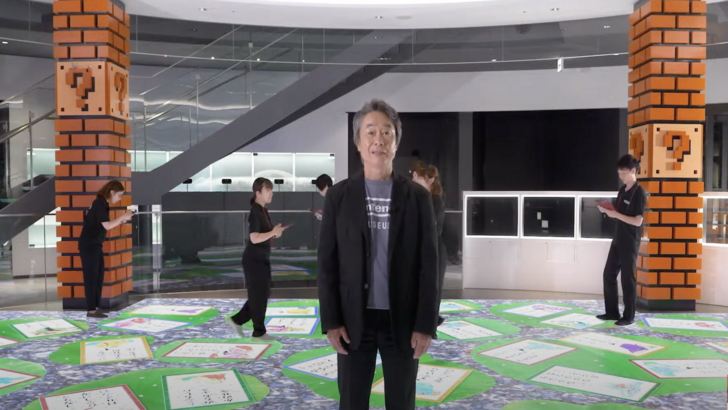 Kyoto's Nintendo Museum Unveils Mario Arcade Classics and Baby Strollers
Legendary game designer and Mario creator Shigeru Miyamoto has given fans an exciting sneak peek into Nintendo's newest museum through a recently shared tour video. This video showcases the gaming giant's rich history spanning over a century, highlighting the upcoming Nintendo Museum in Kyoto, Japan
Apr 25,2025 - ◇ "SD Gundam G Generation ETERNAL Now Available on Android" Apr 25,2025
- ◇ How to Get I Caught a Shooting Star Trophy/Achievement in Monster Hunter Wilds Apr 25,2025
- ◇ "Tribe Nine Unveils Chapter 3 Trailer: Neo Chiyoda City Coming Soon!" Apr 25,2025
- ◇ "Using Tarot Cards Effectively in Balatro: A Guide" Apr 25,2025
- ◇ Next-Gen Xbox Slated for 2027, Handheld in 2025 Apr 25,2025
- ◇ "Switch 2 Zelda Ports: Repair Equipment via Zelda Notes App" Apr 25,2025
- ◇ M3GAN Re-Release: Enhanced with 'Second Screen' and Live Chatbot Apr 25,2025
- ◇ Red Rising Board Game Now 54% Off on Amazon Apr 25,2025
- ◇ Matt Murdock and Wilson Fisk Face New Foe in Daredevil: Born Again Apr 25,2025
- ◇ Madame Bo Set to Enter Mortal Kombat 1 Apr 25,2025


- 1 Pokémon GO Set To Roll Out Safari Ball In The Wild Area Event 2024 Nov 10,2024
- 2 Marvel's Spider-Man 2 Swings to PC in January 2025 May 26,2023
- 3 Tomorrow: MMO Nuclear Quest Is a New Sandbox Survival RPG Nov 15,2024
- 4 Black Myth: Wukong Review Fallout Nov 13,2024
- 5 Roblox Ban in Turkey: Details and Reasons Mar 10,2024
- 6 Final Fantasy XVI PC Port Falls Short Nov 14,2024
- 7 GTA 6 Raises The Bar and Delivers on Realism Beyond Expectations Nov 10,2024
- 8 Dragonite Cross-Stitch Captivates Pokémon Enthusiasts Nov 08,2024


-
Best Racing Games to Play Now
A total of 10
-
Explore the World of Shooting Games
A total of 10
-
Best Free Simulation Games for Your Android Phone
A total of 4