AlpineQuest Explorer Lite
- Travel & Local
- 2.3.8d
- 8.0 MB
- by Psyberia
- Android 2.1+
- Apr 26,2025
- Package Name: psyberia.alpinequest.free
Turn your phone into a real off-road GPS using offline topo maps!
No advertisements ~ No data sharing & monetization ~ No analytics ~ No third party libraries
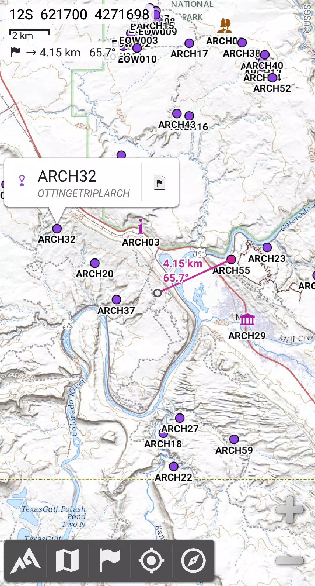
AlpineQuest is the complete solution for all outdoor activities and sports, including hiking, running, trailing, hunting, sailing, geocaching, off-road navigation, and much more.
You can access and store a large range of online topographic maps locally, which remain available even when you're out of cell coverage. AlpineQuest also supports numerous on-board file-based raster map formats.
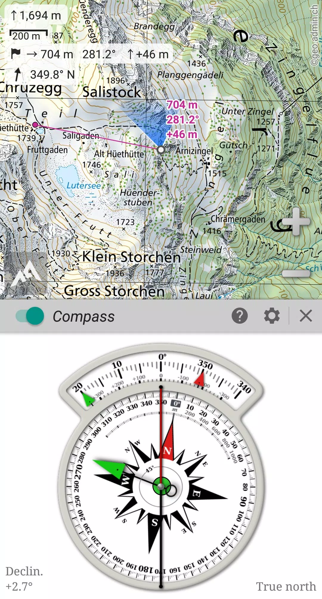
Utilize your device's GPS and magnetic sensor (with a compass display) to ensure you're never lost again. You'll be localized in real-time on the map, which can also be oriented to match your direction of view.
Save and retrieve an unlimited number of placemarks, and share them with your friends. Track your path, access advanced statistics, and view interactive graphics. With AlpineQuest, you'll have all the tools you need to explore and achieve your outdoor goals.
AlpineQuest remains fully operational even out of cell coverage, making it perfect for exploring deep wilderness areas, whether in the mountains or abroad.
Don't hesitate, try this Lite version for free now!
PLEASE report any suggestions or issues on our dedicated forum at https://www.alpinequest.net/forum (no registration required, and all questions will be answered) rather than in the comments section.
Key features (available in the full version) include:
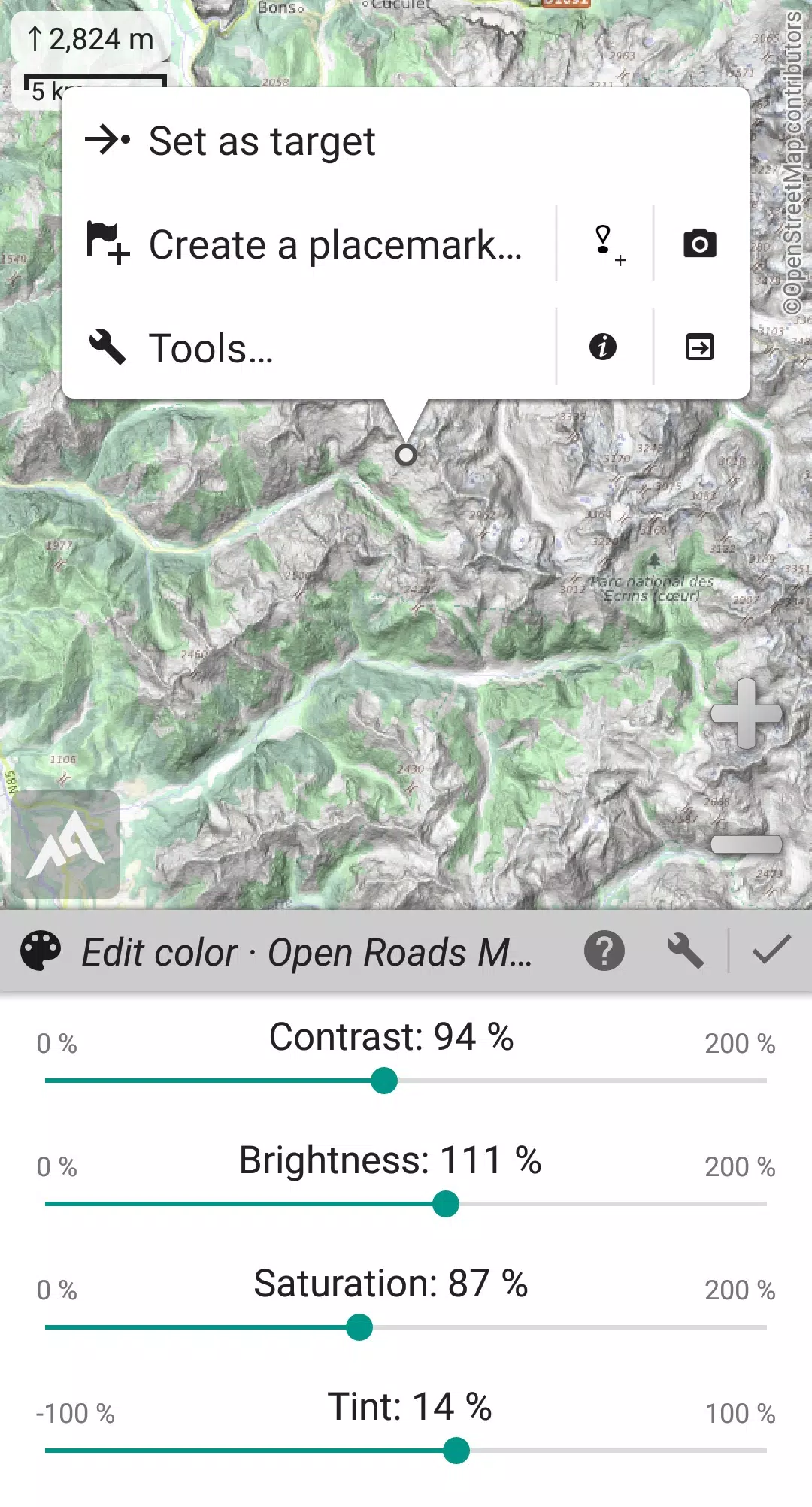
★★ Maps ★★
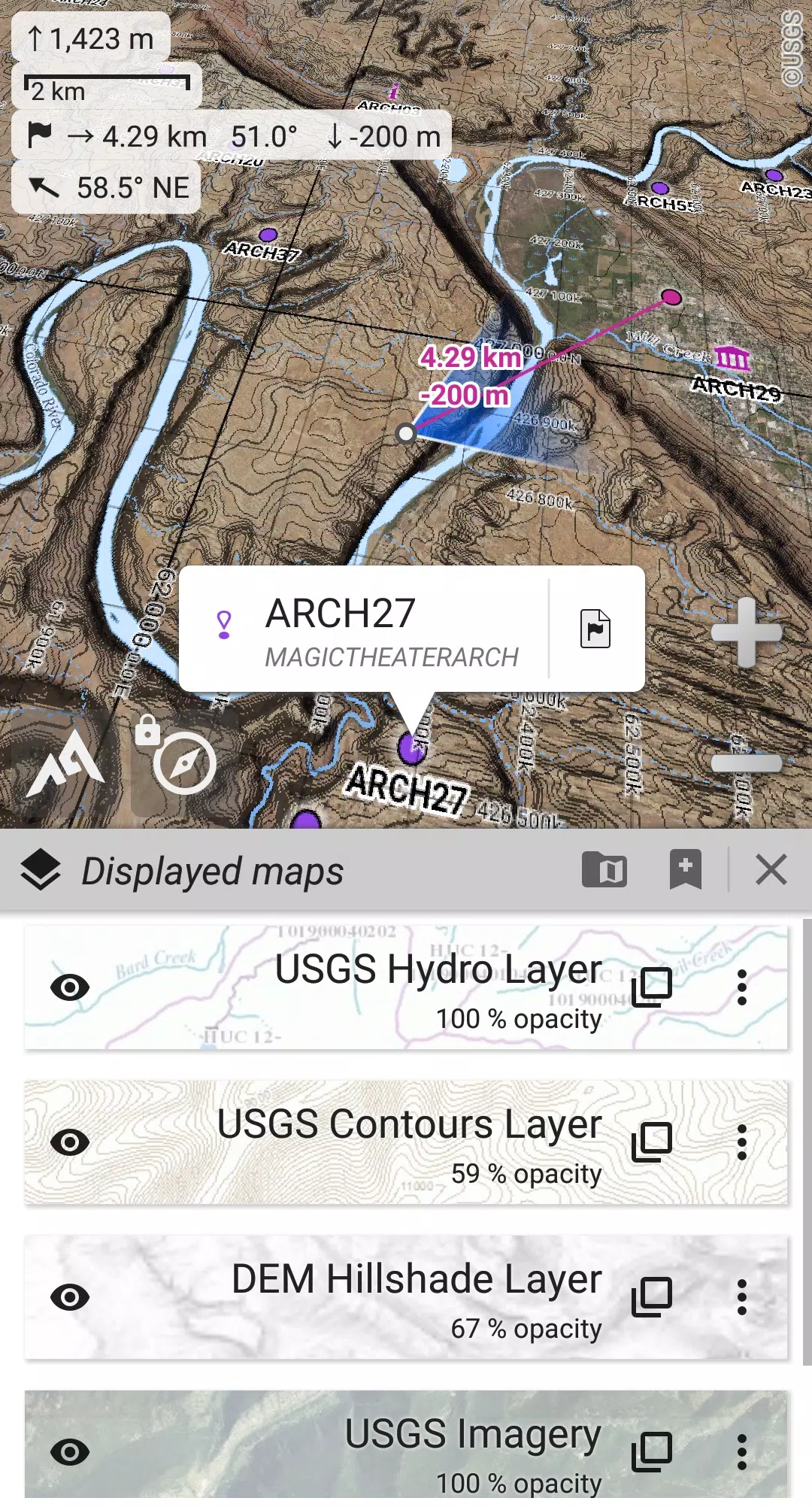
• Access to built-in online maps with automatic local storage; includes road, topo, and satellite maps, along with online layers such as road names, hillshade, and contours.
• Easily access more online maps and layers from our community maps list, which covers major worldwide and many local topo maps.
• Ability to store entire areas of online maps for offline use.
• Support for on-board offline maps (raster), including KMZ Overlays, OziExplorer OZFx2, OZFx3 (partial), calibrated images, GeoTiff, GeoPackage GeoPkg, MbTile, SqliteDB, and TMS zipped tiles. Visit our website to download MOBAC, the free map creator.
• Support for QuickChart Memory Maps (.qct files, .qc3 files not compatible).
• Built-in image calibration tool to transform any scan or picture into a usable map.
• Digital elevation model on-board storage (1-arcsec SRTM DEM) and support for HGT elevation files (both 1-arcsec and 3-arcsec resolutions) for displaying terrain, hillshade, and steep slopes.
• Support for polar maps (Arctic and Antarctic).
• Display multiple maps in layers with customizable opacity, contrast, color, tint, and blending controls.
★★ Placemarks ★★
• Create, display, save, and restore an unlimited number of items such as waypoints, routes, areas, and tracks.
• Import and export GPX files, Google Earth KML/KMZ files, and CSV/TSV files.
• Import ShapeFile SHP/PRJ/DBF, OziExplorer WPT/PLT, GeoJSON, IGC tracks, Geocaching LOC waypoints, and export AutoCAD DXF files.
• Save and share online locations with other users through Community Placemarks.
• Access details, advanced statistics, and interactive graphics for various items.
• Utilize the Time Controller to replay time-tagged tracks.
★★ GNSS Position / Orientation ★★
• On-map geolocation using your device's GNSS receivers (GPS/Glonass/Galileo/…) or network.
• Map orientation with compass and target finder.
• Built-in GNSS/Barometric track recorder (capable of long tracking, runs in a separate, lightweight process) with battery level and network strength recording.
• Set up proximity and leave path alerts.
• Barometer support for compatible devices.
★★ And more ★★
• Choose between metric, imperial, nautical, and hybrid distance units.
• Use various latitude/longitude and grid coordinate formats (WGS, UTM, MGRS, USNG, OSGB, SK42, Lambert, QTH, …) with on-map grids display.
• Import hundreds of coordinate formats from https://www.spatialreference.org.
• …
What's New in the Latest Version 2.3.8d
Last updated on Aug 14, 2024
2.3.8b/c/d
• New setting to customize the display style and side of the menu bar.
• Enhanced compatibility with recent Android versions.
• Improved backup and restore functionality.
• Updated default URL for sharing coordinates as text.
• Option to set the application’s “Media” folder as the default for placemarks, icons, pictures, and file-based maps.
• Added Croatian and Persian language support.
• Various improvements and bug fixes.
-
mBDL

-
Nawgati (CNG Eco Connect)

-
Meru Cabs- Local, Rental, Outs

-
Unreserved: Bus Timetable App

-
HogeNood - find toilets

-
GangaSagar - Vessel Time Table

-
NYC Transit: MTA Subway Times

-
Билеты ЖД

-
m-Indicator: Mumbai Local

-
MyMRTJ

-
Go2Joy - Hourly Booking App

-
VoiceTra(Voice Translator)

-
Egypt's Trains - Voice Search

-
Stayflexi

-
 "Defeating the Viper in The First Berserker: Khazan - Strategies Revealed"
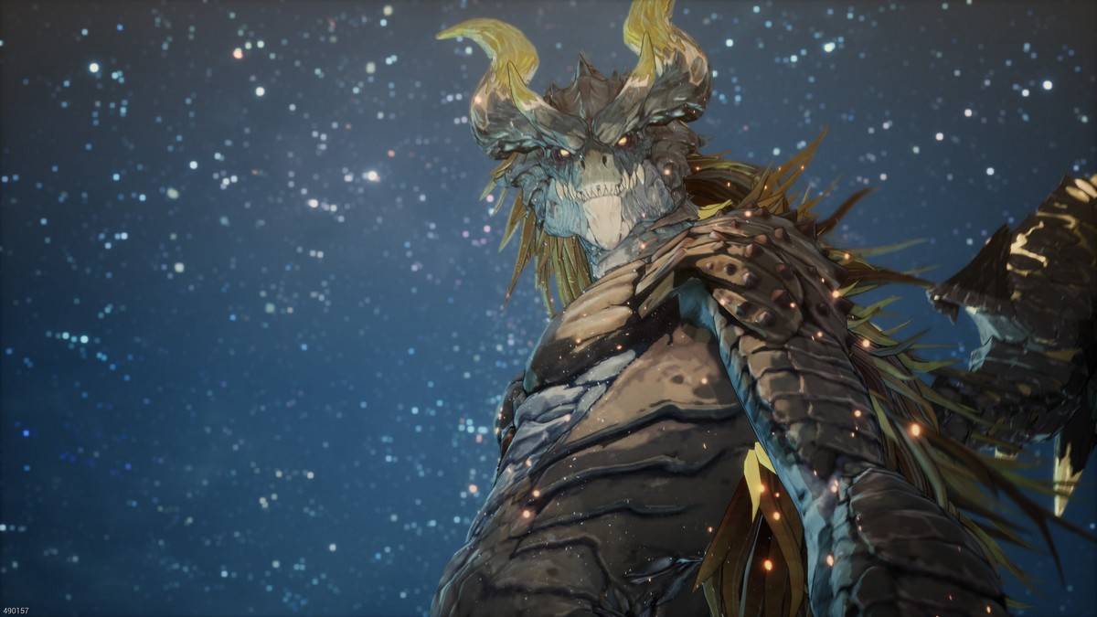
In the *Dungeon Fighter Online* universe, the dragonkin have long been a formidable challenge for heroes, and this continues in *The First Berserker: Khazan*. Facing the Viper, a high-ranking dragonkin created by Hismar to lead defeated dragons and sow chaos, requires strategic caution. Here's how t
Apr 26,2025 -
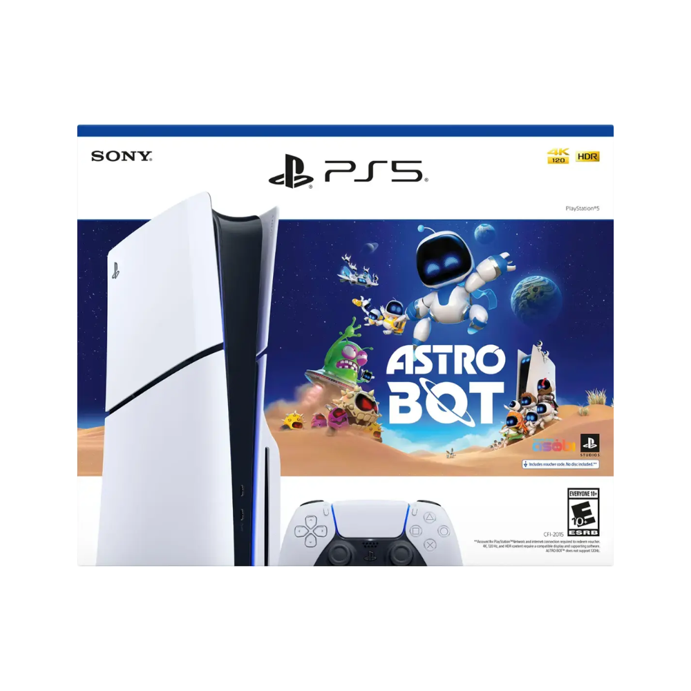 PS5 Astro Bot Bundle Is Now Available, and Includes 2024 GOTY Winner for Free
If you're considering purchasing a PS5 in 2025, the PlayStation 5 Slim Astro Bot bundle stands out as an exceptional deal. The Disc model is currently available at Best Buy for $449.99, while the Digital Edition can be found at Amazon for $399.99, with wider availability expected soon.What sets this
Apr 26,2025 - ◇ "Snaky Cat: Slither, Compete, and Outlast Opponents in New Game" Apr 26,2025
- ◇ Scarlet Girls Tier List for the Best Characters Apr 26,2025
- ◇ "Metal Gear Solid Delta: Snake Eater Release Date Unveiled in New Trailer" Apr 26,2025
- ◇ What Are Bookshelves and Why Are They Needed Apr 26,2025
- ◇ Unveil 5 Secret Missions in Pokemon TCG Pocket: Space-Time Smackdown Completion Guide Apr 26,2025
- ◇ Mirren: Star Legends - A Beginner's Guide Apr 26,2025
- ◇ Touchgrind BMX 3: Rivals Renamed from Touchgrind X Apr 26,2025
- ◇ "Prison Gang Wars: A Gritty Simulation of Incarcerated Life" Apr 26,2025
- ◇ Izuna's Backstory and Skills in Blue Archive Revealed Apr 26,2025
- ◇ Alienware 4K OLED Gaming Monitor Now at Lowest Price Ever Apr 26,2025


- 1 Pokémon GO Set To Roll Out Safari Ball In The Wild Area Event 2024 Nov 10,2024
- 2 Marvel's Spider-Man 2 Swings to PC in January 2025 May 26,2023
- 3 Tomorrow: MMO Nuclear Quest Is a New Sandbox Survival RPG Nov 15,2024
- 4 Black Myth: Wukong Review Fallout Nov 13,2024
- 5 Roblox Ban in Turkey: Details and Reasons Mar 10,2024
- 6 Final Fantasy XVI PC Port Falls Short Nov 14,2024
- 7 GTA 6 Raises The Bar and Delivers on Realism Beyond Expectations Nov 10,2024
- 8 Dragonite Cross-Stitch Captivates Pokémon Enthusiasts Nov 08,2024


-
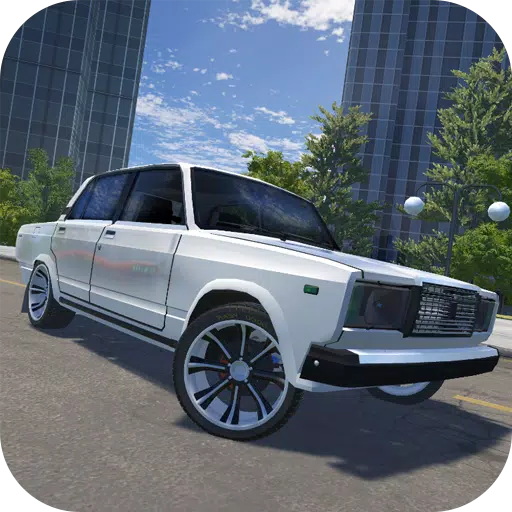
Best Racing Games to Play Now
A total of 10
-
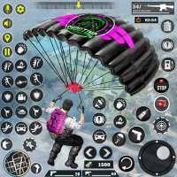
Explore the World of Shooting Games
A total of 10
-
Best Free Simulation Games for Your Android Phone
A total of 4